| PORT ALLEGANY, PA, USA |
West Longitude (-78.29039) North Latitude (+41.82308) Elevation (~1500' Above Sea Level)
|
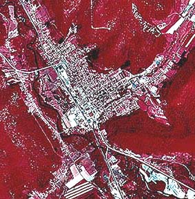 |
Infra-red Aerial Image of Port Allegany (June 1989) North is at the top, route 6 exits the lower right corner for Coudersport and the upper left side for Smethport. Route 155 exits both the top and bottom heading for Eldred and Emporium respectfully. Dark red areas are wooded, while pink areas are fields. White areas are concrete/dirt/bare areas. The Allegheny River is a barely visible dark ribbon. Lillibridge Creek extends up and to the right. This image was scanned from an original 9"x9" color photo provided by the US Geological Survey. |
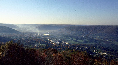 |
This view of the town looking south on a misty, autumn morning, was taken from atop the old TV tower. The large white structure in the far center is Ball Foster (tall batch tower is to the left). Mobile homes can be seen in lower right (Park Lane Drive). Pitt-Corning is the group of gray-roofed buildings in the center. Most of the town is hidden by trees. Photo by T L McCormick |